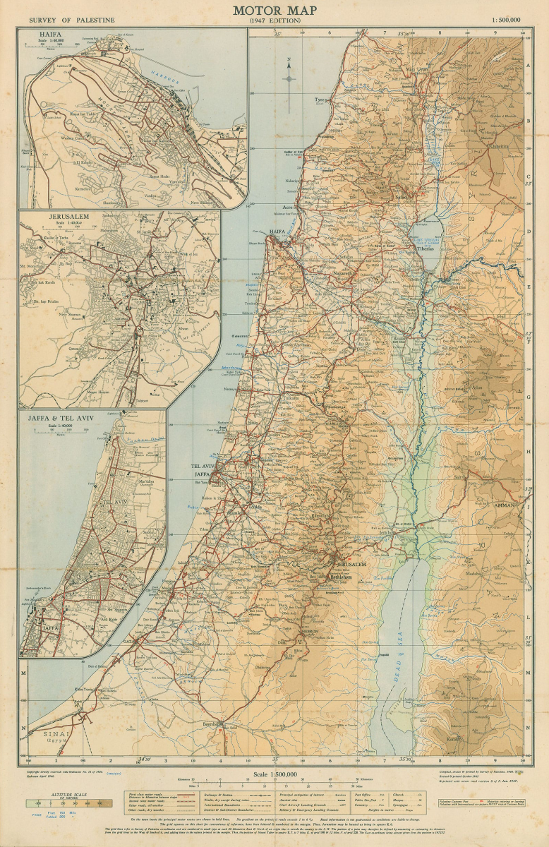
The 1947 motor map was based on the 1946 British Survey of Palestine and shows the towns and villages of Palestine before partition. The same map was overprinted in Hebrew in 1951 and shows the 1948 armistice lines and the villages and settlements following the ethnic cleansing of Palestine in 1948. The individual maps can be viewed in their entirety by using the slider in the centre of the image. [With thanks to Dr Muneir Waheed for the 1947 motor map, and to Dr Uri Davis for providing a copy of the 1951 map of Eretz Yisrael/Palestine].